Uttarakhand’s early-warning system at Vasundhara Tal is a welcome advance. But technology alone cannot protect vulnerable communities from the mounting risks of a warming Himalaya.
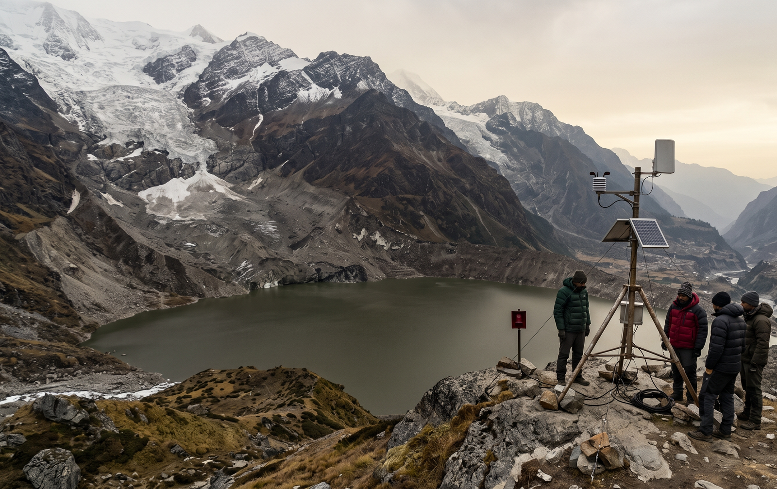
The Himalaya is sending an unmistakable warning. As glaciers retreat and glacial lakes expand, the risk of sudden, devastating floods is becoming harder to ignore. Uttarakhand’s installation of its first sensor-based early-warning system at Vasundhara Tal, in Chamoli district, marks a significant step towards confronting this danger. Yet the real test will be whether scientific intelligence translates into timely action and lives saved.
Completed in its first phase in October 2026, the system monitors water levels, weather conditions, snow cover and ground movements at an altitude of approximately 4,800 metres. Uttarakhand has identified 13 high-risk glacial lakes, five of them in the very-high-risk category. The initiative is therefore not simply a technological milestone; it is an acknowledgement that disaster preparedness must begin long before the floodwaters arrive.
The scientific evidence is sobering. The International Centre for Integrated Mountain Development reported in 2023 that glaciers across the Hindu Kush Himalaya lost ice 65% faster during 2011–20 than in the preceding decade. Separately, Indian Space Research Organisation satellite observations found that 676 of 2,431 glacial lakes larger than 10 hectares, identified across Indian Himalayan river basins, had expanded since 1984. Of these expanding lakes, 601 had more than doubled in size.
When a natural barrier fails, a glacial lake outburst flood can unleash torrents of water, rock and debris, devastating settlements, roads, bridges and hydropower infrastructure downstream. The consequences extend beyond mountain communities: the Ganga and its tributaries connect Himalayan hazards to densely populated plains, where millions depend on river systems for water, agriculture and livelihoods.
This is also a question of regional security. Himalayan watersheds cross political boundaries, making scientific cooperation between India, Nepal and China increasingly important. Shared data, compatible warning protocols and coordinated disaster planning must complement domestic preparedness.
Sensors, however sophisticated, cannot evacuate a village. Authorities need reliable communications, mapped flood routes, functioning sirens, trained rescue teams and regular evacuation drills. Remote-sensing technology and ground surveys must also identify unstable slopes and vulnerable settlements.
The ultimate measure of success is not the number of sensors installed, but the number of lives protected. In a warming world, preparedness is not optional: it is a moral obligation to vulnerable communities and future generations.
Author

Related Stories



Most Read
- 1Argentina’s ‘Vanishing Sea’: Rare Low Tide
- 2Effect of the 12 August 2026 Solar Eclipse on the 12 Zodiac Signs, Know Who Will Benefit and Who Will Have to Be Careful
- 3HC finds peon’s dismissal over tea and biscuits amounted to ‘injustice’
- 4Brace for 29 June: a Capricorn Full Moon, Mercury retrograde and Jupiter’s leap into Leo
- 5Japan Coach’s Whiteboard Tactics Go Viral at FIFA World Cup