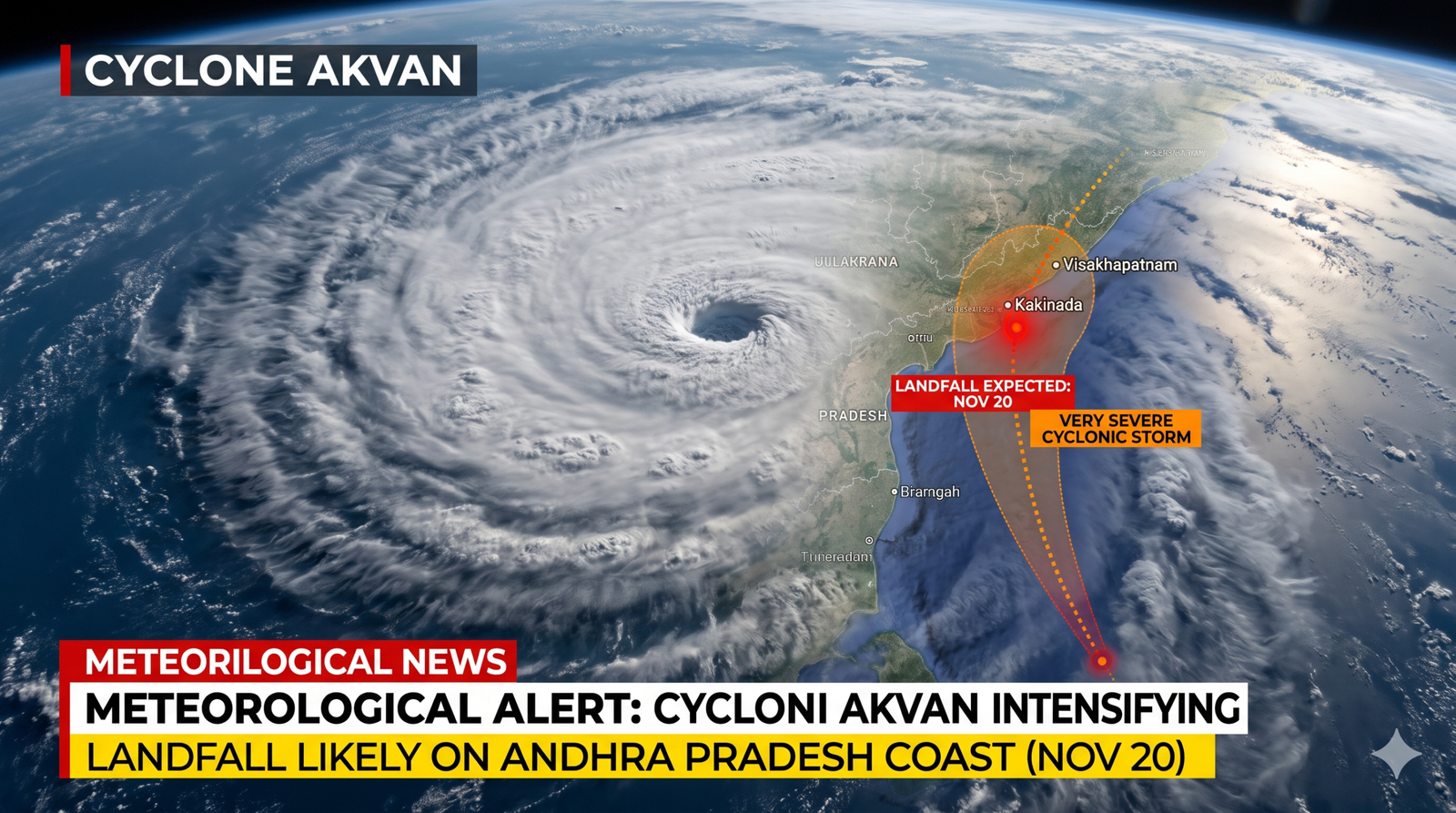
The India Meteorological Department (IMD) has warned that Cyclone Akvan is likely to intensify into a Very Severe Cyclonic Storm by November 19, bringing heavy rainfall, powerful winds and rough sea conditions across several parts of eastern and southern India.
Cyclone Akvan, which is currently moving over the central and adjoining west-central Bay of Bengal, is expected to gain strength over the next two days, according to the latest weather bulletin issued by the India Meteorological Department (IMD) on November 17.
The weather department has forecast that the storm could intensify into a Severe Cyclonic Storm by the evening of November 17, followed by further strengthening into a Very Severe Cyclonic Storm around the morning of November 19.
Cyclone Akvan: When and Where Will It Make Landfall?
According to the IMD, Cyclone Akvan is moving slowly in a north-northwestward direction and is expected to continue moving northwestwards over the Bay of Bengal.
The cyclone is likely to make landfall along the Andhra Pradesh and Yanam coasts between Nellore and Tuni around noon on November 20.
At the time of landfall, the storm is expected to have maximum sustained wind speeds of 120–130 kmph, with gusts reaching up to 145 kmph.
The IMD has warned that the cyclone could cause significant weather disturbances along the coastal belt, particularly in areas likely to experience strong winds, heavy rainfall and storm surges.
Heavy Rainfall Alert for Andhra Pradesh, Odisha and Telangana
The approaching cyclone is expected to trigger widespread rainfall across several states in southern and eastern India.
Coastal Andhra Pradesh and Yanam are likely to experience fairly widespread to widespread rainfall between November 19 and 21. Heavy to very heavy rainfall is expected at a few places on November 19 and 20, with isolated extremely heavy rainfall also possible.
Telangana is likely to receive widespread rainfall on November 20 and 21, with isolated very heavy rainfall during this period.
The weather department has also forecast heavy rainfall over Rayalaseema on November 20, while Tamil Nadu, Puducherry and Karaikal may experience isolated heavy rainfall on November 19.
Odisha is also expected to experience significant weather activity. Widespread rainfall is likely between November 19 and 21, with isolated very heavy rainfall during the same period.
Jharkhand and Bihar May Also Experience Weather Changes
The impact of Cyclone Akvan is expected to extend beyond the coastal regions.
According to the IMD forecast, Jharkhand is likely to experience fairly widespread to widespread rainfall on November 20 and 21. Isolated heavy rainfall is also expected during these two days.
Gangetic West Bengal is likely to receive widespread rainfall between November 19 and 21, while Bihar may experience isolated rainfall on November 21.
Residents in these states should keep track of the latest weather updates, particularly as rainfall and wind conditions may change with the movement and intensity of the cyclone.
Strong Winds and Storm Surge Warning
The IMD has issued warnings regarding powerful winds over the Bay of Bengal and along the eastern coastline.
Wind speeds over the west-central Bay of Bengal are expected to increase to 120–130 kmph, with gusts reaching up to 145 kmph from November 19 evening until landfall on November 20.
Along the Andhra Pradesh and Yanam coasts, wind speeds could also reach 120–130 kmph, gusting up to 145 kmph.
A storm surge of approximately 1–2 metres above the astronomical tide is likely to inundate low-lying coastal areas of Andhra Pradesh, including Prakasam, Bapatla, Krishna, West Godavari, Konaseema and Kakinada districts.
The IMD has indicated that the peak storm surge is expected over Bapatla, Krishna and West Godavari districts between the morning and afternoon of November 20.
Sea conditions are also expected to deteriorate, becoming phenomenal over parts of the west-central Bay of Bengal from November 19 until landfall.
Fishermen Advised Not to Venture Into the Sea
Considering the expected intensification of Cyclone Akvan, the IMD has advised fishermen not to venture into several parts of the Bay of Bengal.
The restrictions cover the southeast Bay of Bengal until November 18, the southwest and west-central Bay of Bengal until November 20, the east-central Bay of Bengal until November 18, and the northwest Bay of Bengal on November 19 and 20.
People involved in fishing and maritime activities have been advised to follow official weather warnings and avoid entering affected sea areas.
IMD Issues Safety Advisory Amid Cyclone Threat
The weather department has warned that strong winds and heavy rainfall could damage vulnerable structures, uproot trees, affect standing crops and disrupt road and rail transportation.
Low-lying areas may experience waterlogging, inundation and localised flooding. Small boats, trawlers and ships may also be affected by deteriorating sea conditions.
The IMD has advised people in affected regions to monitor official weather updates and move to safer locations whenever necessary. Residents have also been advised not to take shelter under trees during thunderstorms and to stay away from water bodies and electrical conductors during lightning activity.
Farmers in potentially affected regions have been advised to harvest mature crops, protect stored agricultural produce and ensure proper drainage in agricultural fields.
With Cyclone Akvan expected to intensify further over the Bay of Bengal, the coming days will be crucial for coastal Andhra Pradesh and other eastern and southern states. Authorities and residents are being urged to remain alert and follow the latest advisories issued by the India Meteorological Department.
Inputs: IMD Press Release
Author

Related Stories




Most Read
- 1Argentina’s ‘Vanishing Sea’: Rare Low Tide
- 2Effect of the 12 August 2026 Solar Eclipse on the 12 Zodiac Signs, Know Who Will Benefit and Who Will Have to Be Careful
- 3Powai: Minor Girl Sexually Assaulted by Six Men, All Accused Arrested Within 24 Hours
- 4HC finds peon’s dismissal over tea and biscuits amounted to ‘injustice’
- 5Japan Coach’s Whiteboard Tactics Go Viral at FIFA World Cup